
TL;DR
A Chinese research team has created a satellite-based model that accurately estimates the surface temperature of photovoltaic panels at utility-scale solar farms. The method corrects for mixed land cover and array geometry, enabling more reliable performance assessment from space. Validation shows significant error reduction compared to previous approaches.
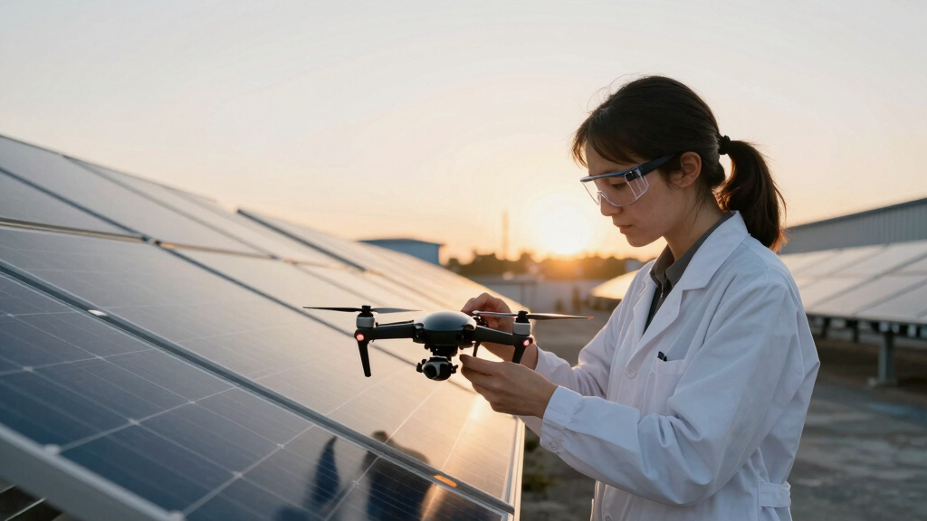
A Chinese research team has introduced a novel satellite-based model that accurately estimates the surface temperature of photovoltaic panels at utility-scale solar farms, overcoming previous limitations caused by mixed land cover and array geometry. This breakthrough enables more reliable remote monitoring of solar farm performance, which is critical for grid management and renewable energy integration.
The team developed a scene-aware retrieval model using MODIS thermal infrared satellite data, which typically has a spatial resolution of 1 km. This resolution covers large areas that include PV panels, inter-row gaps, surrounding ground, and other land cover types. To isolate the PV surface temperature, the researchers combined high-resolution Sentinel-2 imagery to estimate the fractional PV coverage within each MODIS pixel. They then used a three-dimensional geometric model of the PV array layout, considering tilt, azimuth, and viewing angles, to determine the visible panel surface area from space.
By explicitly modeling the thermal contributions of non-panel components, the approach corrects for mixed signals and directional emissivity effects. Validation against ground-based thermocouples at two Chinese sites—one arid and one humid—showed a substantial reduction in error, decreasing the root mean square error (RMSE) from 10.8–18.9°C to 3.7–8.6°C. The method also significantly mitigated systematic cold bias, improving accuracy by roughly 10°C, which translates into a 3–5% decrease in PV power simulation bias.
While effective in warm seasons, the method faces challenges in winter due to shadows and snow cover, which can lead to underestimation of panel temperatures. The researchers plan to develop techniques to account for shaded gaps and extend the model’s applicability globally and across different array types.
Enhanced Satellite Monitoring for Solar Panel Performance
This development matters because it enables more precise, satellite-based monitoring of PV panel temperatures, which are crucial for assessing solar farm efficiency and predicting energy output. Accurate thermal data from space can improve performance diagnostics, facilitate remote asset management, and support grid stability efforts, especially as solar capacity expands globally.
By addressing the limitations of traditional land surface temperature retrievals, this method offers a scalable solution for large-scale solar farms, reducing reliance on ground sensors and enabling real-time performance tracking across remote or numerous sites. It also advances the potential for integrating satellite data into energy forecasting models, aiding policymakers and industry stakeholders in making informed decisions about renewable energy deployment.
BNB SP-160 Digital Panel Thermometer, Solar Powered, Remote Probe. Monitor Temperature Inside Coolers, Freezers, Walk-Ins, Lab Enclosures. External Power Not Required. Surface-Mount.
SOLAR-POWERED Thermometer with battery back-up. Large, easy-read LCD Display. Always on. °F/°C switchable. Remote thermistor probe on 3.2…
As an affiliate, we earn on qualifying purchases.
As an affiliate, we earn on qualifying purchases.
Advances in Satellite-Based PV Temperature Measurement
Historically, estimating PV panel temperatures from space has been challenging due to the complex scene composition of solar farms and the low, directional emissivity of PV panels. Conventional methods often relied on land surface temperature models that did not account for array geometry or mixed land cover, leading to significant errors. The use of MODIS data for this purpose has been limited, with accuracy hampered by these factors.
This new approach builds on prior research by incorporating scene-aware corrections, high-resolution imagery, and detailed geometric modeling. Validation studies in China demonstrate the method’s potential, with plans underway to expand testing to different climates and array configurations.
“Our method goes beyond conventional land surface temperature retrievals by accounting for the three-dimensional structure of PV arrays, changes in the apparent panel area with viewing angle, and the unusually low, directional emissivity of PV panels.”
— Kun Yang, corresponding author

TOPDON TC004 Mini Thermal Imaging Camera, 240 x 240 TISR Resolution, 15-Hour Battery Life, 128 x 128 IR Resolution, 25Hz Handheld Infrared Camera with High/Low Temp Alerts, Auto Shutdown- Blue
【Enhanced Thermal Clarity】Start with 128×128 thermal imaging and enhance to 240×240 resolution with TISR technology for greater details….
As an affiliate, we earn on qualifying purchases.
As an affiliate, we earn on qualifying purchases.
Winter Conditions and Shaded Gaps Still Challenging
The researchers acknowledge that winter conditions, such as shadows and snow cover, still pose significant challenges for accurate satellite-based PV temperature retrieval. The current model underestimates temperatures in shaded areas, which can lead to inaccuracies in performance assessment during colder months. Developing methods to account for shaded gaps and snow cover remains an ongoing effort.
Additionally, the model’s applicability across different climate zones, array types, and tracking systems is still being tested, and the full extent of its accuracy in diverse conditions is not yet confirmed.

FrogBro Upgrade Solar Panel Tester Meter Photovoltaic Multimeter 800W, Solar MPPT Meter with Large Ultra Clear LCD, Smart MPPT Open Circuit Voltage Troubleshooting Utility Tool for Solar PV Testing
We firmly believe that quality shapes the future. FROGBRO is dedicated to continuously crafting and refining tools that…
As an affiliate, we earn on qualifying purchases.
As an affiliate, we earn on qualifying purchases.
Expanding Validation and Improving Winter Accuracy
The next steps include testing the model on more solar farms with varied climates and array configurations, including fixed-tilt and tracking systems. The team aims to develop algorithms that better estimate shaded and snow-covered areas, improving winter performance estimates.
Further integration of this satellite-based approach into operational monitoring systems and energy forecasting tools is expected, along with efforts to produce a global dataset of PV panel temperatures for research and industry use.

Renogy Battery Temperature Sensor Solar Panel for New Edition Voyager Charge Controllers, Black
Compatible with 10A/20A Voyager Models
As an affiliate, we earn on qualifying purchases.
As an affiliate, we earn on qualifying purchases.
Key Questions
How does this new satellite method improve PV temperature measurement?
It corrects for mixed land cover, array geometry, and directional emissivity effects, significantly reducing errors compared to previous models and enabling more accurate remote temperature estimation.
Can this method be used for real-time monitoring?
While promising, further development is needed to enable real-time application. Validation and integration into operational systems are ongoing processes.
What are the limitations of the current approach?
It performs less accurately in winter due to shadows and snow cover, and its applicability across different climates and array types is still being tested.
Will this help improve solar farm performance predictions?
Yes, more accurate temperature data can enhance performance models and energy forecasts, supporting better operational decisions and grid management.
Source: PV Magazine